GeoServer Blog
GeoServer 2.4.2 released
The GeoServer team is pleased to announce the release of GeoServer 2.4.2:
This is a stable release containing bug fixes and incremental improvements, including:
-
Total matched feature count available in JSON output (contributed by Paul Biskup)
-
Ability to control how scale hints are computed in WMS 1.1 (contributed by Roy Braam and Mauricio Pazos)
-
Support for randomized symbol fills in both SLD and CSS (thanks to New South Wales Geological survey for sponsoring it)
-
Better support for data with 3D coordinates using GML3/GeoJSON, and associated improvements in the SQL Server backend (thanks to IGEA, Croatia, for sponsoring this work)
-
WCS 1.0 can be disabled
-
Several translation updates and improvements, thanks to the translation team. In no particular order: Polish, Korean, German, Lithuanian, Spanish, Romanian, French
-
Several small fixes in the docs (thanks to all the good people that contributed them!)
This release is made in conjunction with GeoTools 10.2.
Spot a translation mistake? Help translate here: GeoServer Stable localisation
About the GeoServer 2.4 series
The following change control requests were completed during the development of GeoServer 2.4:
-
Replace old KML module with new one (GSIP 98)
-
Allow plugins to modify WMS MapContent before map rendering (GSIP 92)
-
Machinery to pass thread locals down in thread pools (GSIP 96, fixes WPS asych requests security issues) - also available in 2.3.4
-
Promote CSS Styling module from Community to Extension (GSIP 97) - also available in 2.3.2
-
Graduate the INSPIRE module to extension status (GSIP 94) - also available in 2.3.2
-
Promote XSLT community module to extension (GSIP 93) - also available in 2.3.1
-
The shapefile datastore was completely rewritten (mostly as a code cleanup)
Articles and blogs during GeoServer 2.4 development:
-
GeoServer FOSS4G 2013 (State of GeoServer, Introduction, Steroids, GeoFence, RasterData, Spatio-Temporal, Cartographic Rendering )
-
How to publish GDAL/MrSID image formats on a production GeoServer
-
FOSS4G-NA slides (GeoServer In Production, GeoServer CSS Module, Scripting GeoServer with GeoScript, The State of GeoServer 2013)
-
INSPIRE Conference 2013 slides (Analysing GeoServer compatibility with INSPIRE requirements)
-
FOSSGIS 2013 slides (Introduction to GeoServer)
GeoServer 2.4.1 Released
The GeoServer team is pleased to announce the release of GeoServer 2.4.1:
This is a stable release containing bug fixes and incremental improvements, including:
-
CSW admin page
-
Fixed deployment without web jars
-
Polygon fill margin vendor option in CSS
-
Automatically link CSW (ISO) records to the respective WMS/WFS/WCS sources
This release is made in conjunction with GeoTools 10.1.
Spot a translation mistake? Help translate here: GeoServer Stable localisation
About the GeoServer 2.4 series
The following change control requests were completed during the development of GeoServer 2.4:
-
Replace old KML module with new one (GSIP 98)
-
Allow plugins to modify WMS MapContent before map rendering (GSIP 92)
-
Machinery to pass thread locals down in thread pools (GSIP 96, fixes WPS asych requests security issues) - also available in 2.3.4
-
Promote CSS Styling module from Community to Extension (GSIP 97) - also available in 2.3.2
-
Graduate the INSPIRE module to extension status (GSIP 94) - also available in 2.3.2
-
Promote XSLT community module to extension (GSIP 93) - also available in 2.3.1
-
The shapefile datastore was completely rewritten (mostly as a code cleanup)
Articles and blogs during GeoServer 2.4 development:
-
GeoServer FOSS4G 2013 (State of GeoServer, Introduction, Steroids, GeoFence, RasterData, Spatio-Temporal, Cartographic Rendering )
-
How to publish GDAL/MrSID image formats on a production GeoServer
-
FOSS4G-NA slides (GeoServer In Production, GeoServer CSS Module, Scripting GeoServer with GeoScript, The State of GeoServer 2013)
-
INSPIRE Conference 2013 slides (Analysing GeoServer compatibility with INSPIRE requirements)
-
FOSSGIS 2013 slides (Introduction to GeoServer)
GeoServer 2.4.0 Release Highlights
We noticed out friends at Slashgeo could not quite figure out what is new with the GeoServer 2.4.0 release - so we have updated the release announcement with a 2.4.0 feature list.
For a more complete story check out the State of GeoServer 2013 presentation on on elogeo or slideshare.
Let me call out several significant developments from the GeoServer product story:
-
CSS Extension: David Winslow is a long standing member of the GeoServer community, however his most significant work has been hiding in the community modules. With this release of GeoServer the CSS module has become a formal GeoServer extension.
 This module being brought into core is having a serious impact on the GeoServer usability story and is an excellent contribution. The documentation has been updated with a complete CSS cookbook (as a counterpoint to the SLD cookbook) and represents a great learning aid.
Talking points: there are some technical reasons (the CSS module is written in Scala rather than Java) why it has remained a community module up until now. The GeoServer community opening up, even a little bit, to other JVM languages is an interesting change of strategy.
This module being brought into core is having a serious impact on the GeoServer usability story and is an excellent contribution. The documentation has been updated with a complete CSS cookbook (as a counterpoint to the SLD cookbook) and represents a great learning aid.
Talking points: there are some technical reasons (the CSS module is written in Scala rather than Java) why it has remained a community module up until now. The GeoServer community opening up, even a little bit, to other JVM languages is an interesting change of strategy. -
**Time boxed release model: **GeoServer 2.4.0 was released on time with little drama.
 Talking points: This is kind of old news now, but with all the mad panic around FOSS4G releases seen over the course of the week I have to call out the GeoServer community for being excellent. It is not enough to release open source software, releasing on schedule is the new normal.
 -
**NetCDF and GeoTools Raster API improvements **
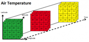 Talking points: This change is flying under the radar, but is significant from a product story as it is opening up new markets to the GeoServer application. It is a long term play, and there is work to be done, but it is wonderful to see the first steps taken in a responsible and measured manner.
 -
Importer community module (heading to extension shortly!) offering a wizard like process for the bulk publication of data, automating common activities such as transformation and generation of default styling.
 Talking points: This represents a significant contribution from the downstream OpenGeo Suite being donated back to the GeoServer community to enable collaboration and improvement. GeoServer has a number of downstream distributions and this is a great example of healthy community participation.
GeoServer FOSS4G 2013
The GeoServer community was out in force at FOSS4G.
GeoServer Workshops
GeoServer was well represented at a range of workshops:
-
W17: A complete open source web mapping stack (Introduction to the OpenGeo Suite): Jeffrey Johnson (Boundless)
-
W18: Introduction to Mobile Web Development Using FOSS4G: Krisztian Olle (Envitia)
-
W5: OGC services with GeoServer: from journeyman to master: Andrea Aime (GeoSolutions), Simone Giannecchini (GeoSolutions)
-
W19: Introduction To High Availability Clusters With GeoServer And GeoWebCache: Simone Giannecchini (GeoSolutions S.A.S.)
-
W20: SpatioTemporal Data Handling With GeoServer: An Introduction With Examples For MetOc And Remote Sensing Data For WMS And WCS: Simone Giannecchini (GeoSolutions S.A.S.)
-
W23: WPS With GeoServer: Tom Kunicki (Boundless)
Highlights, Notes and Quotes:
-
Andrea talking off the cuff for 30 mins (with Jody offering live whiteboard slides) while waiting for the overhead projector to be fixed.
-
Workshops are the highlight of foss4g!


GeoServer Presentations
We had a strong GeoServer thread on the second day, and a smattering of coverage throughout the conference.
-
GeoServer for Spatio-temporal Data Handling With Examples For MetOc And Remote Sensing
-
Table Joining Service Implementation Using The GeoServer Platform: José Luis Capote Fernández
-
Real-time Data Analysis And Rendering With HTML5 Canvas Using OpenLayers And GeoServer (video)
-
Raster data in GeoServer and GeoTools: Achievements, issues and future developments (video)
-
GeoCat Bridge - Publish From ArcGIS Desktop Into FOSS4G (video)
-
Ordnance Survey – open source at the heart of the enterprise
-
Open Source Web And Mobile Mapping Applications In Utilities And Telcos
The big news was the live release of GeoServer 2.4.0 during the State of GeoServer presentation. Thanks to Andrea and Jody for representing the team with an entertaining, if fast paced, presentation.
A quick shout out to elgeo and locationtech for capturing both the slides and recording the sessions from FOSS4G 2013.


Highlights, Notes and Quotes:
-
Members of the audience performing a GeoServer cloud deploy while waiting for the State of GeoServer talk
-
Q: When is 2.4.0 being released
-
A: Now!
-
Q: What are your plans for GeoServer 3 A: We would only make a GeoServer 3 if we have to break backwards compatibility. The team is doing an excellent job and I hope, for our customers, that we are never forced to make a GeoServer 3.0 release.
-
Q: Who is is that person with Andrea? A project manager or something? A: ….
Code Sprint
Niels, in addition to being charming, was the force behind this years GeoServer code sprint.


As per ourinterview with Frank translation has been a great community priority. One of the steps to getting the imported module ready for use as an extension is to make sure it is ready to be translated. Niels had just finished the CSW admin page and hit the ground running. With a bit of help from Ian Turton, the team was able to get a pull request done during the code sprint.
One of the best ways to thank the code sprint team is to dive in and translate this new functionality, and sure enough when I checked this work is quickly getting done.
![]()
Thanks Niels, Ian and crew! I hope to see more GeoServer developers at FOSS4G Portland!
GeoServer 2.4 Released!
The GeoServer team is pleased to announce the final release of GeoServer 2.4.0. Some great final bug fixes reported from 2.4-RC2 made it into this release. Check out the change log for the details. More Information about the new and noteworthy of the GeoServer 2.4 series can be found here.
Its worth to announce that GeoServer is available in for more languages: Spanish, French, Polish and Romanian. Many thanks to Jorge Sanz, Alexandre Gacon, Jaros?aw P?kal and Sorin C?linic? for their contributions. Again, feel free to join a translation team and review existing translations at Transifex.
A special thank you to those who helped test all the beta and release candidates.
Download the new release, try it out, and be sure to report any issues found in the bug tracker or on the mailing list. Thanks for using GeoServer!
About the GeoServer 2.4 series
The following change control requests were completed during the development of GeoServer 2.4:
-
Replace old KML module with new one (GSIP 98)
-
Allow plugins to modify WMS MapContent before map rendering (GSIP 92)
-
Machinery to pass thread locals down in thread pools (GSIP 96, fixes WPS asych requests security issues) - also available in 2.3.4
-
Promote CSS Styling module from Community to Extension (GSIP 97) - also available in 2.3.2
-
Graduate the INSPIRE module to extension status (GSIP 94) - also available in 2.3.2
-
Promote XSLT community module to extension (GSIP 93) - also available in 2.3.1
-
The shapefile datastore was completely rewritten (mostly as a code cleanup)
Articles and blogs during GeoServer 2.4 development:
-
How to publish GDAL/MrSID image formats on a production GeoServer
-
FOSS4G-NA slides (GeoServer In Production, GeoServer CSS Module, Scripting GeoServer with GeoScript, The State of GeoServer 2013)
-
INSPIRE Conference 2013 slides (Analysing GeoServer compatibility with INSPIRE requirements)
-
FOSSGIS 2013 slides (Introduction to GeoServer)
Tutorials
- How to style layers using GeoServer and QGIS
- How to Publish a GeoTIFF file in GeoServer
- A Comprehensive Guide to Publishing a Shapefile in GeoServer
- GeoServer About & Status - A Practical Guide
- GeoServer installation methods on Windows
- Introducing GeoSpatial Techno with a Video Tutorial
- GeoServer Presentations on FOSS4G 2019