GeoServer 2.4.0 Release Highlights
We noticed out friends at Slashgeo could not quite figure out what is new with the GeoServer 2.4.0 release - so we have updated the release announcement with a 2.4.0 feature list.
For a more complete story check out the State of GeoServer 2013 presentation on on elogeo or slideshare.
Let me call out several significant developments from the GeoServer product story:
-
CSS Extension: David Winslow is a long standing member of the GeoServer community, however his most significant work has been hiding in the community modules. With this release of GeoServer the CSS module has become a formal GeoServer extension.
 This module being brought into core is having a serious impact on the GeoServer usability story and is an excellent contribution. The documentation has been updated with a complete CSS cookbook (as a counterpoint to the SLD cookbook) and represents a great learning aid.
Talking points: there are some technical reasons (the CSS module is written in Scala rather than Java) why it has remained a community module up until now. The GeoServer community opening up, even a little bit, to other JVM languages is an interesting change of strategy.
 -
**Time boxed release model: **GeoServer 2.4.0 was released on time with little drama.
 Talking points: This is kind of old news now, but with all the mad panic around FOSS4G releases seen over the course of the week I have to call out the GeoServer community for being excellent. It is not enough to release open source software, releasing on schedule is the new normal.
 -
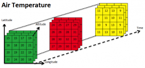
**NetCDF and GeoTools Raster API improvements **
 Talking points: This change is flying under the radar, but is significant from a product story as it is opening up new markets to the GeoServer application. It is a long term play, and there is work to be done, but it is wonderful to see the first steps taken in a responsible and measured manner.
 -
Importer community module (heading to extension shortly!) offering a wizard like process for the bulk publication of data, automating common activities such as transformation and generation of default styling.
 Talking points: This represents a significant contribution from the downstream OpenGeo Suite being donated back to the GeoServer community to enable collaboration and improvement. GeoServer has a number of downstream distributions and this is a great example of healthy community participation.
Behind The Scenes
- GeoServer 3 Sprint Update
- GeoServer 2025 Q4 Developer Update
- GeoServer 3 Crowdfunding Goal Surpassed!
- GeoServer 2025 Q2 Developer Update
- GeoServer 3 Crowdfunding – Last Call!
- GeoServer 3 Crowdfunding Campaign Reaches Major Step: 80% Funding Completion
- GeoServer 2025 Roadmap
- GeoServer 2024 Q4 Developer Update
- GeoServer 3 Call for Crowdfunding
- GeoServer 2024 Q3 Developer Update