GeoServer 2.15.0 Released
| The GeoServer team is happy to announce the GeoServer 2.15.0 release with downloads (zip | war | exe), documentation (html | pdf) and extensions. |
This release is production ready and is ready to work with your Java 8 or Java 11 operational environment. This release is made in conjunction with GeoWebCache 1.15.0 and GeoTools 21.0.
The ability to work with Java 11 is the result a dedicated code sprint. Thanks to organizations participating in the code sprint (Boundless, GeoSolutions, GeoCat, Astun Technology, CCRi) along with sprint sponsors (Gaia3D, atol, osgeo:uk, Astun Technology).
Layer Service Settings
To start things off an often requested capability, the ability to control which services are enabled on a layer-by layer basis.
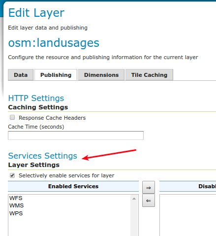
To try it our yourself see Service Settings in our user manual.
GeoFence Internal Server Extension
Originally a standalone service offering fine grain control over GeoServer security this functionality has been packaged up and embedded into a GeoServer extension for easier deployment.
-
GeoFence rules provided greater control over security allowing layer by layer service restrictions
-
GeoFence rules can provide access to data overriding layer details including CQL filter to limit contents returned and default style used for rendering
-
GeoFence rules can limit access to a geographic extent
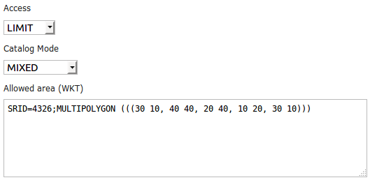
For more details see GeoFence Internal Server in our user manual.
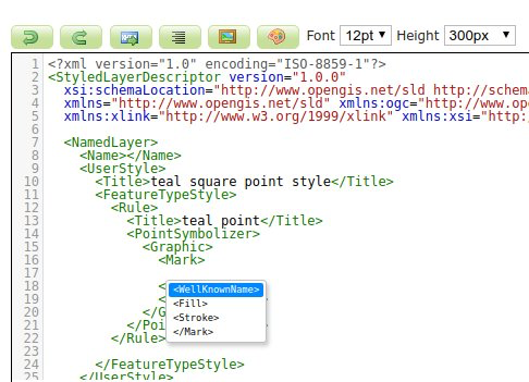
Style Editor SLD Auto-Complete
To help make editing easier the Style Editor can provide auto-complete suggestions for SLD 1.0. To try it out yourself use control-space for context aware suggestions.
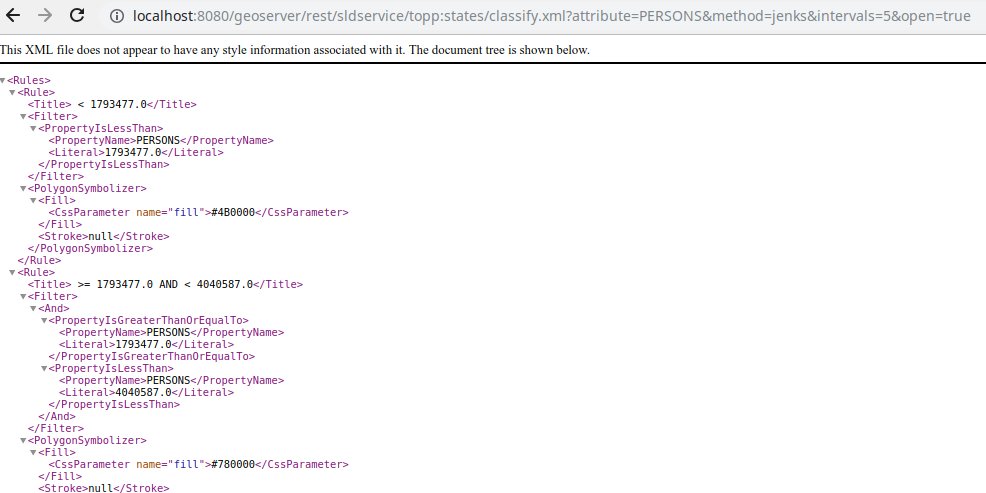
Generate Classified Thematics maps
SLDService is now an official extension, with a number of improvements. SLDService can now be used for the
-
classification of raster data too
-
equal area classification
-
standard deviation filtering
The SLD REST Service extension is used to generate thematic styles based on attribute data:
curl -v -u admin:geoserver -XGET
  http://localhost:8080/geoserver/rest/sldservice/states/classify.xml
  ?attribute=PERSONS
  &ramp=CUSTOM
  &method=quantile
  &intervals=3
  &startColor=0xFF0000
  &endColor=0x0000FF
  &open=true
For more information see SLD Rest Service in our user manual.
WPS GetExecutionStatus and Dismiss Operations
WPS “GetExecutions” vendor operation allows each user to get the list of running processes:
-
Users can review all their running processes
-
Administrators can see all processes
The Dismiss vendor operation can be used to cancel the execution of one of the listed processes.
For more information see Dismiss in our user guide.
Java 11 Support
The provided binary download works with either Java 8 or Java 11. Tomcat 9 or newer is required for the WAR install. The user guide compatibility list will continue to be updated based on your feedback.
The java ecosystem is now being led by the open source OpenJDK project, with long term support available from a range of organizations notably RedHat OpenJDK and Adopt OpenJDK. The GeoTools user guide provides an overview of Java 8 and Java 11 distributions.
The net effect of these changes:
-
If you have been using Oracle JDK please review your options
-
Java 8 will continue to be available
-
The Java ecosystem is now led by the open-source Open JDK project
Java 11 no longer supports the Java 2 extension mechanism used for native JAI and native ImageIO libraries. We recommend the use of the pure Java JAI-EXT operations which have been made the default (see the next section).
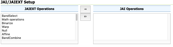
JAI-EXT operations on by default
The use of the JAI-EXT operations have long been a recommendation, with this release we are making them the default for GeoServer. The JAI-EXT library offers a pure java implementation enhanced for geospatial functionality supporting NODATA pixels and support for vector footprints.
GeoServer Codebase
In addition to Java 11 support this release includes:
-
Add JSON as a Legend Output format (GISP 173)
-
Printing plugin upgrade version of JTS
-
Upgrade NetCDF dependencies
-
Improvements for vector tile production, both in terms of output correctness and production performance
Thanks to Andrea Aime for steady work on the codebase quality:
-
PMD source code analysis, high priority checks, will fail the build in case of issues
-
Error Prone byte code analysis, same as above
-
Many small bugs fixed
For more details developers are invited to review Automated Quality Assurance checks in our developers manual. Also, work in ongoing on the master (dev) branch to extend the reach of static code checks using SpotBugs and CheckStyle too.
About GeoServer 2.15 Series
Additional information on the GeoServer 2.15 series:
-
Release Notes (2.15.0 2.15-RC 2.15-M0) - Running on Java 11 (User Manual)