GeoServer 3.0.2 Release
GeoServer 3.0.2 release is now available with downloads (bin, war, windows), along with docs and extensions.
This is a stable release of GeoServer recommended for production use. GeoServer 3.0.2 includes the latest GeoTools 35.2, GeoWebCache 2.0.2, along with mapfish-print-v2 2.5.2 and ImageN 0.9.3. There is a new GeoServer Cloud 3.0.2 release - representing the first time an updated GeoServer Cloud is made available on release day.
Thanks to Jody Garnett (GeoCat) for making this release, Andrea Aime (GeoSolutions) for testing, and Alessio Fabiani (GeoSolutions) Gabriel Roldan (Camptocamp) for the GeoServer Cloud release.
Security Considerations
This release addresses security vulnerabilities and is an important upgrade for production systems. Details about the fixes will be provided at the start of November.
See project security policy for more information on how security vulnerabilities are managed.
OGC API Maps 1.0
The OGC API Maps community module has been aligned with the final OGC API - Maps 1.0.0 standard.
-
Dataset map: Draw several collections into a single map, choosing and ordering them with the
collectionsparameter. The map preview provides a palette to select collections, the first one drawn at the bottom.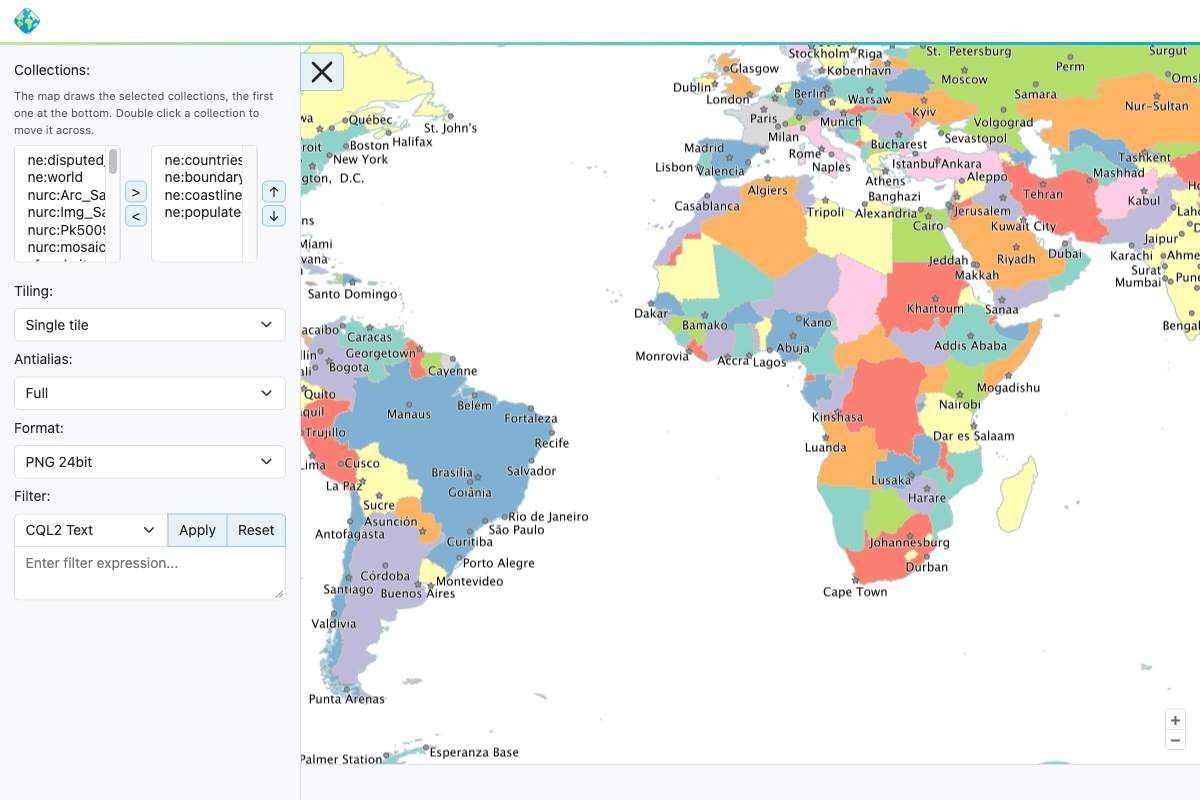
-
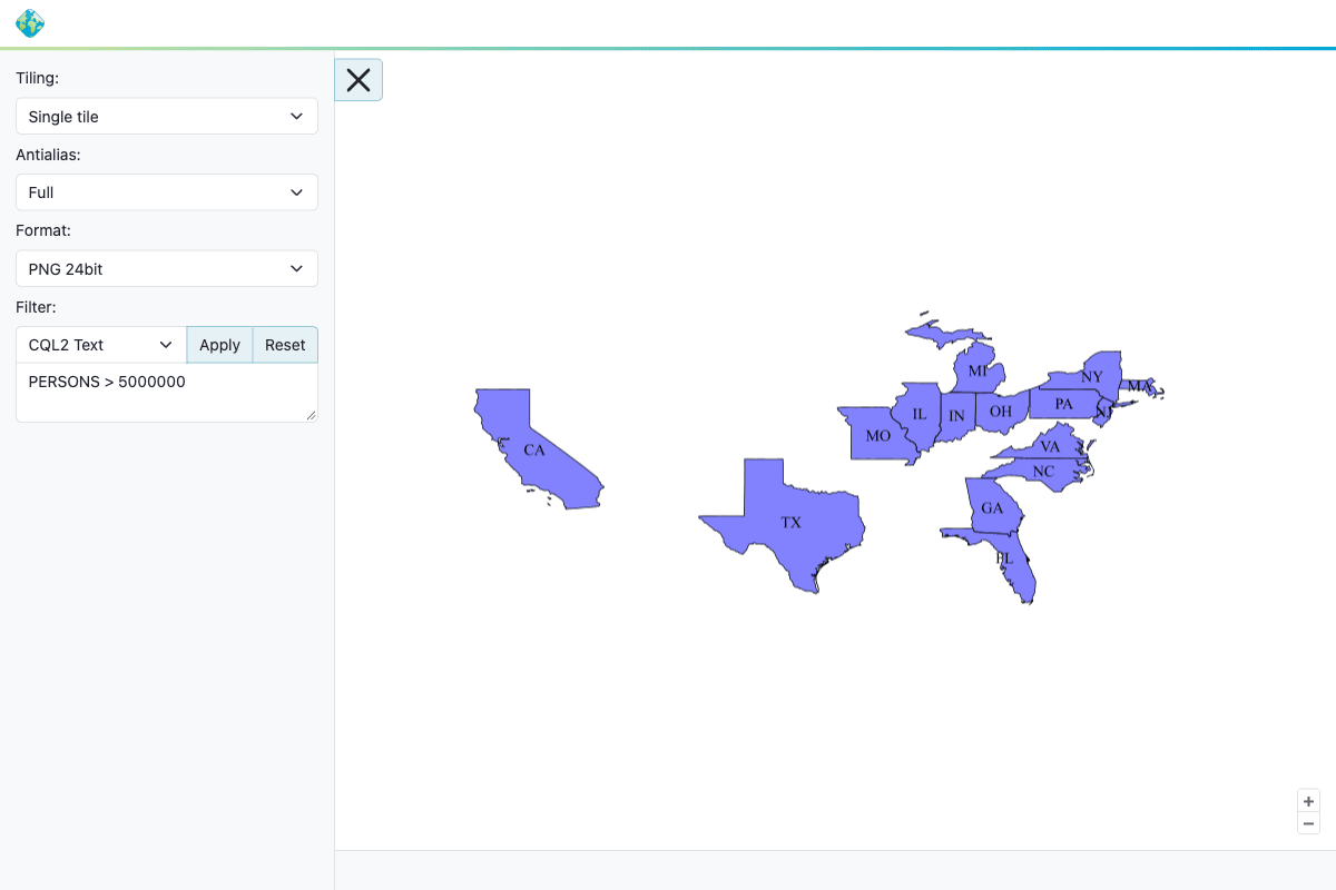
Filtering: Maps can be filtered using CQL2 Text, CQL2 JSON or ECQL, using the queryable attributes of each collection.
-
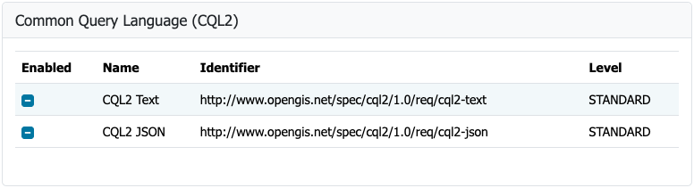
Conformance: Each optional conformance class (subsetting, scaling, background, crs, output formats, and more) can be enabled or disabled from the Services > Mapping settings page. Invalid parameters are now reported as a bad request rather than an internal error.
For more information see OGC API Maps in the user manual.
Thanks to Andrea Aime (GeoSolutions) for the OGC API - Maps development, and Jody Garnett (GeoCat) for the 3.0.x backport and improvements to the conformance table editor.
- GEOS-12161 Align OGC API Maps to v1.0.0
- GEOS-12163 Expose filtering in OGC API Maps
- GEOS-12167 Add dataset map support in OGC API Maps
GeoFence for GeoServer 3
The GeoFence extensions are now available for GeoServer 3, completing Milestone 4: Integration of the GeoServer 3 crowdfunding campaign.
GeoFence has been updated to Jakarta EE, Spring Framework 7 and Hibernate 7:
- The
geofenceplugin now communicates with a standalone GeoFence server using REST, as Spring remoting is no longer available. - The embedded
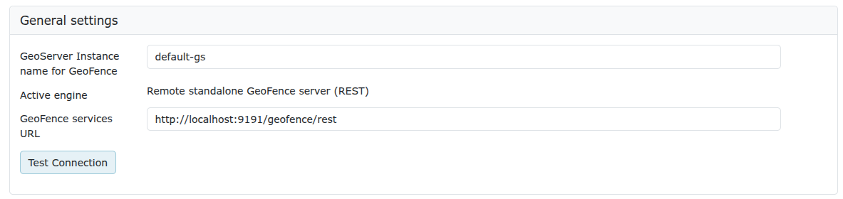
geofence-serverrequires a PostgreSQL / PostGIS database, H2 is no longer supported. - The GeoFence admin page is found under the Security menu, showing the active engine and GeoFence services URL.
Existing GeoFence users should review the migration guide before upgrading, as the datasource configuration file has been renamed and the GeoFence authentication provider has been removed.
Thanks to Emanuele Tajariol (GeoSolutions) for this work, and to the GeoServer 3 crowdfunding sponsors for making it possible.
- GEOS-12192 GeoFence: align to GeoServer3
GeoServer 3 is supported by the following organisations:

























Individual donations: Abhijit Gujar, Hennessy Becerra, Ivana Ivanova, John Bryant, Jason Horning, Jose Macchi, Peter Smythe, Sajjadul Islam, Sebastiano Meier, Stefan Overkamp.
FIPS
GeoServer 3.0.2 comes with a new FIPS community module. FIPS 140-3 is a United States government standard for cryptography modules, and many federal agencies and their suppliers are only allowed to run software that uses a validated one. In summary:
- The FIPS module replaces the regular BouncyCastle library with the FIPS-validated one and runs it in approved-only mode.
- Passwords are stored with AES-GCM.
- A new FIPS tab under Server Status shows the overall cryptographic setup (see screenshot below).
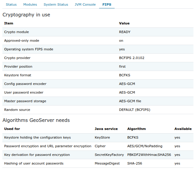
Keep in mind that the module works on Linux only and needs a new data directory: there is no migration tool yet for an existing one.
- GEOS-12178 FIPS community module
- GEOS-12123 Login failure in FIPS mode for GeoServerDigestPasswordEncoder
Thanks to Andrea Aime (GeoSolutions) for the FIPS module development.
Release notes
New Feature:
- GEOS-12180 Add support for multi-layer tile caching (coalescing) in GWC
Improvement:
- GEOS-10029 Use XML schema in applicationContext files
- GEOS-12154 Improve URL validation in SLD processing
- GEOS-12170 Centralize CRS list management across OGC APIs
- GEOS-12176 Encrypt URL parameters with AES instead of DES
- GEOS-12177 Do not hardcode algorithms in the security tests
- GEOS-12179 Name the keystore file after its format, and refuse a mismatched one
- GEOS-12183 CSS can trigger a bean loading circularity during startup
- GEOS-12184 WCS Img coverage encoders subtly depend on gt-image
- GEOS-12187 GeoJSON vector tiles are empty when the layer is meta-tiled
- GEOS-12195 Refactoring of service resolution in Dispatcher
- GEOS-12198 Support single-tenant Microsoft Entra ID authentication
- GEOS-12199 Apply the catalog’s entity resolver consistently to stored query parsing
- GEOS-12203 OIDC: let the identity provider assert the built-in “admin” account
- GEOS-12205 Support GDAL 3.12+ new Raster Attribute Table data types
- GEOS-12207 Layer preview feature info works poorly with long attribute names/values
- GEOS-12208 RAT table view does not scroll any longer
- GEOS-12209 Allow admins to request all layers from CSW endpoints
- GEOS-12211 WPS: clean up GDAL configuration parsing
- GEOS-12218 The print extension ships with a snapshot jar
- GEOS-12231 Extension lookups take a global fair lock to read the JSONP setting
- GEOS-12234 Report invalid connection settings when saving JDBC user/group, role and authentication services
- GEOS-12235 Centralize remote IP resolution into a servlet filter
- GEOS-12237 The style editor layer preview breaks with invalid chars in style names
- GEOS-12238 CSW: Clearer exception in DirectDownload invalid requests
- GEOS-12239 Read JDBC user and role property values as text
- GEOS-12240 Clearer stored query error messages when query id is too long
Bug:
- GEOS-12053 OGCAPI Features unable to disable core or enable draft / community standards
- GEOS-12056 OGC API CQL conformance URIs are wrong
- GEOS-12123 Login failure in FIPS mode for GeoServerDigestPasswordEncoder
- GEOS-12143 Cannot create a tiled layer from the “tile caching” layer tab any longer
- GEOS-12159 ReprojectingFeatureCollection throws ClassCastException reprojecting per-feature geometry between two Geographic 3D CRSs
- GEOS-12172 Some testcases have overly verbose logging
- GEOS-12174 Blob store creation fails under containerd — missing depends-on on gwcBlobStoreAggregator
- GEOS-12193 “Encode coordinates measures” gives different geometries per GML version
- GEOS-12200 GS3: Style Editor Color Helper layout broken
- GEOS-12206 WMTS Multidim operations (DescribeDomains/GetHistogram/…) do not honor datasecurity
- GEOS-12213 Changing the workspace of a WMS/WMTS cascaded store does not update its layers
- GEOS-12216 Datadir loader fails on cross-workspace resource references
- GEOS-12225 Session ID rotates on every request when the admin password is still the default
- GEOS-12229 Backup and restore: after a job has been stopped, later backups and restores end STOPPED
- GEOS-12230 Backup and restore: a full restore loses cascaded WMS/WMTS layers and workspace layer groups, and can empty its own archive
Task:
- GEOS-11975 MapML extension / GeoServer 3.0 SNAPSHOT with MapML extension won’t start
- GEOS-12160 Add URL checks to wps-download-plugin
- GEOS-12171 Update to ImageN 0.9.3
- GEOS-12181 Update gs-web-app to jetty.ee11 testing
- GEOS-12186 Update to JakartaEE Servlet
- GEOS-12188 GS3: jetty e11 de-dup warnings due to servlet-api compile scope
- GEOS-12192 GeoFence: align to GeoServer3
- GEOS-12241 MapFish Print 2.5.2 Update
For the complete list see 3.0.2 release notes.
Community Updates
Community module development:
- GEOS-12161 Align OGC API Maps to v1.0.0
- GEOS-12163 Expose filtering in OGC API Maps
- GEOS-12167 Add dataset map support in OGC API Maps
- GEOS-12178 FIPS community module
- GEOS-12182 Support Azure SAS token authentication for COG stores
- GEOS-12191 GS3: TilesServiceInfoImpl and ImagesServiceInfoImpl both configure tiles.xml
- GEOS-12219 Remove the gwc-sqlite community module
- GEOS-12221 WPS Longitudinal Profile: compute distances on the ground
- GEOS-12222 JWT-Header: Improvements and documentation clarifications
- GEOS-12236 Support conformance classes in OGC API Styles
Community modules are shared as source code to encourage collaboration. If a topic being explored is of interest to you, please contact the module developer to offer assistance.
About GeoServer 3.0 Series
Additional information on GeoServer 3.0 series:
- GeoServer 3.0 User Manual
- GeoServer 3.0-RC, a crowdfunded success story
- GSIP-221 MkDocs Migration
- GSIP-226 GeoServer 3
- GSIP-233 Community Pending Profile
- GSIP-236 Lightening up the Core for GeoServer 3
- GSIP-238 UI / UX Refresh
- GSIP 239 Promote OIDC Community Module to Extension
 Atom feed