GeoServer Blog
GeoSever 2.14.1 released
| We are happy to announce the release of GeoServer 2.14.1. Downloads are provided (zip | war | exe) along with docs (html | pdf) and extensions. |
This is a stable release of the GeoServer 2.14 series and is recommended for all production systems. Users of prior releases of GeoServer are encouraged to upgrade.
This release is made in conjunction with GeoTools 20.1 and GeoWebCache 1.14.1. Thanks to all who contributed to this release.
| For more information please see our release notes (2.14.1 | 2.14.0 | 2.14-RC). |
Improvements and Fixes
This release includes a number of new features and improvements:
-
New coordinate formatting options for WFS layers
-
REST API granule management remove of metadata or all
-
Coverage view support for indexed color model
-
Check handling of WCS 2.0 time/elevation/range subsetting
-
WFS 1.1.0 handling of gml:id
-
WFS Shapefile and GeoJSON output now support geometry with measures
-
Fixes to the start.bat and shutdown.bat scripts on windows
About GeoServer 2.14 Series
Additional information on the GeoServer 2.14 series:
-
New MongoDB extension added
-
Style editor improvements including side by side editing
-
Nearest match support for WMS dimension handling
-
Upgrade notes documenting REST API feature type definition change
-
State of GeoServer 2.14 (SlideShare)
-
GeoServer Ecosystem (SlideShare)
-
GeoServer Developers Workshop (SlideShare)
GeoServer 2.13.3 released
We are happy to announce the release of GeoServer 2.13.3. Downloads are available (zip, war, and exe) along with docs and extensions.
This is a maintenance release recommended for production use (for newer projects please use the 2.14.x series, as 2.13.x will cease to be supported in a few months). This release is made in conjunction with GeoTools 19.3 and GeoWebCache 1.13.3.
| Highlights of this release are featured below, for more information please see the release notes (2.13.3 | 2.13.2 | 2.13.1 | 2.13.0 | 2.13-RC1 | 2.13-beta). |
Improvements and Fixes
-
Allow selection of geometry attribute in app-schema, support mapping files over HTTP connection, push spatial filters over nested geometries down into SQL when possible
-
Performance improvement when reporting dimension values in WMS capabilities, for dimensions out of raster data and presented as “interval and resolution”
-
WCS thread safety fixes when using requests with reprojection and rescaling under high load. Also, when requesting an area inside the bounds of a sparse mosaic, the result might have had less pixels than requested.
-
CSS translator fixed to support mark offset/anchors based on expressions
-
File chooser autocomplete had duplicate entries on Linux
-
REST config, it was not possible to set the default style using a layer PUT
-
GetLegendGraphic ignores the OnlineResource configured in the style for raster layers
About GeoServer 2.13 Series
Additional information on the 2.13 series:
-
Isolated workspaces (User Guide)
-
Coverage views from heterogeneous bands (User Guide)
-
State of GeoServer 2.13 (slideshare)
-
See the GeoServer 2.13.0 released announcement for visual guide to new features
GeoServer the most popular choice for Brazil SDI
Last week the Brazilian government released a list of government agencies that have already implemented their spatial data infrastructure (SDI). This list has 21 agencies, and the interesting thing is that 18 out of 21 use GeoServer in their SDI.
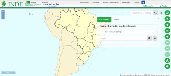 Portal of Brazil’s spatial data infrastructure
Brazil has a 2008 decree, which establishes the creation of spatial data infrastructure by government agencies, and since then, this process of spatial data availability has been growing in the country.
Below, the GeoServer address of some of these agencies:
A spatial data infrastructure (SDI) is a data infrastructure implementing a framework of geographic data, metadata, users and tools that are interactively connected in order to use spatial data in an efficient and flexible way (Wikipedia, 2018).
Java 2018 Code Sprint
Java 11 is released tomorrow! GeoServer has a window until January 2019 before Java 8 is no longer officially supported!
To make the transition the GeoServer team is setting up a Java 2018 Code Sprint - and we need your support to help enough participants attend!
-
October 22-26th
-
Groups gathering in North America, Europe and Oceania
With recent policy changes setting the Java platform on a six-month release cycle. We also have significant work ensuring the libraries we use either work with the “jigsaw” module system or are replaced.
Already we have identified changes needed for GeoServer to run at all:
-
Upgrade Spring: The application framework uses the reflection feature of Java to wire GeoServer together - and needs to be updated to work with the additional Java 11 restrictions.
-
Upgrade Log4J: A Java 11 compatible version of Log4J is available and provides tools for visualization and exploring log messages.
-
Repackage the application adding automatic module names
Our goal is to ensure that the next release of GeoServer can run with Java 8 or Java 11.
How to participate
Please visit the osgeo wiki page and add yourself to the list of participants. We are trying to bring as contributors together as possible and would love it if you could join us!
In addition to GeoServer representatives from GeoTools and GeoNetwork will be taking part.
How to sponsor
We have three sponsorship levels available, with contributions devoted to helping participants attend:
-
Gold: $7500 USD
-
Silver: $1500 USD
-
Bronze: $750 USD
Sponsor logos are included on the event page and blog posts in addition to being featured in the associated project release announcements. More importantly your financial support goes towards making sure GeoServer remains available on a supported Java platform.
Please see the wiki page for details on how to sponsor.
GeoServer 2.14.0 Released
We are happy to announce the release of GeoServer 2.14.0. Downloads are available (zip, war, and exe) along with docs and extensions.
This is the first stable release of the 2.14 series of GeoServer, and is recommended for all production systems. With this release, the 2.13 series moves to maintenance, and the 2.12 series moves to unsupported.
This release is made in conjunction with GeoTools 20.o and GeoWebCache 1.14.0
This release includes a number of new features and improvements:
WMS “nearest match” support for time dimension
WMS time dimension can now be configured for “nearest match”, that is, to return the nearest time to the one requested (either explicitly, or implicitly via the default time value).

In case of mismatch the actual time used will be returned along with the response as a HTTP header. It is also possible to configure a maximum tolerance, beyond that the server will throw a service exception.
Channel selection name allow expressions
GeoServer 2.14.0 allows expressions to be used in SourceChannelName SLD elements, and in their code counterpart, thus allowing dynamic channel selection. This is welcomed news for anyone building applications that display multispectral or hyperspectral data, thus avoiding the need to build many different styles for the various interesting false color combinations.
Here is an SLD example:
<code data-blogger-escaped-style="background: transparent; border-radius: 3px; border: 0px; box-sizing: border-box; display: inline; font-family: SFMono-Regular, Consolas, "Liberation Mono", Menlo, Courier, monospace; font-size: 13.6px; line-height: inherit; margin: 0px; overflow: visible; padding: 0px; word-break: normal; word-wrap: normal;"><RasterSymbolizer>
  <ChannelSelection>
    <RedChannel>
      <SourceChannelName>
          <ogc:Function name="env">
             <ogc:Literal>B1</ogc:Literal>
             <ogc:Literal>2</ogc:Literal>
          </ogc:Function>
      </SourceChannelName>
    </RedChannel>
    <GreenChannel>
      <SourceChannelName>
          <ogc:Function name="env">
             <ogc:Literal>B2</ogc:Literal>
             <ogc:Literal>5</ogc:Literal>
          </ogc:Function>
      </SourceChannelName>
    </GreenChannel>
    <BlueChannel>
      <SourceChannelName>
          <ogc:Function name="env">
             <ogc:Literal>B3</ogc:Literal>
             <ogc:Literal>7</ogc:Literal>
          </ogc:Function>
      </SourceChannelName>
    </BlueChannel>
  </ChannelSelection>
<RasterSymbolizer>
</code>
Map algebra
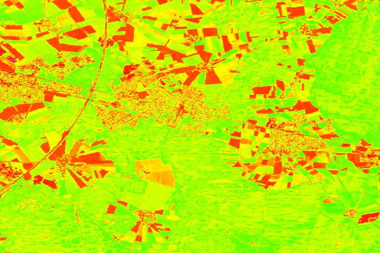
This release adds support for an efficient map algebra package knows as Jiffle. Jiffle has been the work of a former GeoTools contributor, Michael Bedwards, that has been salvaged, upgraded to support Java 8, and integrated in jai-ext. From the there support has been added into the GeoTools gt-process-raster module and as a result in GeoServer WPS, to be used either directly or as a rendering transformation.
The following SLD style calls onto Jiffle to perform a NDVI calculation on top of Sentinel 2 data:
<span data-blogger-escaped-style="border: 0px; color: #007020; font-family: inherit; font-size: 14.4px; font-style: inherit; font-weight: inherit; margin: 0px; padding: 0px; vertical-align: baseline;" class="cp"><?xml version="1.0" encoding="UTF-8"?></span>
<span data-blogger-escaped-style="border: 0px; color: #062873; font-family: inherit; font-size: 14.4px; font-style: inherit; font-weight: bold; margin: 0px; padding: 0px; vertical-align: baseline;" class="nt"><StyledLayerDescriptor</span> <span data-blogger-escaped-style="border: 0px; color: #4070a0; font-family: inherit; font-size: 14.4px; font-style: inherit; font-weight: inherit; margin: 0px; padding: 0px; vertical-align: baseline;" class="na">xmlns=</span><span data-blogger-escaped-style="border: 0px; color: #4070a0; font-family: inherit; font-size: 14.4px; font-style: inherit; font-weight: inherit; margin: 0px; padding: 0px; vertical-align: baseline;" class="s">"http://www.opengis.net/sld"</span>
<span data-blogger-escaped-style="border: 0px; color: #4070a0; font-family: inherit; font-size: 14.4px; font-style: inherit; font-weight: inherit; margin: 0px; padding: 0px; vertical-align: baseline;" class="na">   xmlns:ogc=</span><span data-blogger-escaped-style="border: 0px; color: #4070a0; font-family: inherit; font-size: 14.4px; font-style: inherit; font-weight: inherit; margin: 0px; padding: 0px; vertical-align: baseline;" class="s">"http://www.opengis.net/ogc"</span> <span data-blogger-escaped-style="border: 0px; color: #4070a0; font-family: inherit; font-size: 14.4px; font-style: inherit; font-weight: inherit; margin: 0px; padding: 0px; vertical-align: baseline;" class="na">xmlns:xlink=</span><span data-blogger-escaped-style="border: 0px; color: #4070a0; font-family: inherit; font-size: 14.4px; font-style: inherit; font-weight: inherit; margin: 0px; padding: 0px; vertical-align: baseline;" class="s">"http://www.w3.org/1999/xlink"</span>
<span data-blogger-escaped-style="border: 0px; color: #4070a0; font-family: inherit; font-size: 14.4px; font-style: inherit; font-weight: inherit; margin: 0px; padding: 0px; vertical-align: baseline;" class="na">   xmlns:xsi=</span><span data-blogger-escaped-style="border: 0px; color: #4070a0; font-family: inherit; font-size: 14.4px; font-style: inherit; font-weight: inherit; margin: 0px; padding: 0px; vertical-align: baseline;" class="s">"http://www.w3.org/2001/XMLSchema-instance"</span> <span data-blogger-escaped-style="border: 0px; color: #4070a0; font-family: inherit; font-size: 14.4px; font-style: inherit; font-weight: inherit; margin: 0px; padding: 0px; vertical-align: baseline;" class="na">xsi:schemaLocation=</span><span data-blogger-escaped-style="border: 0px; color: #4070a0; font-family: inherit; font-size: 14.4px; font-style: inherit; font-weight: inherit; margin: 0px; padding: 0px; vertical-align: baseline;" class="s">"http://www.opengis.net/sld</span>
<span data-blogger-escaped-style="border: 0px; color: #4070a0; font-family: inherit; font-size: 14.4px; font-style: inherit; font-weight: inherit; margin: 0px; padding: 0px; vertical-align: baseline;" class="s">http://schemas.opengis.net/sld/1.0.0/StyledLayerDescriptor.xsd"</span> <span data-blogger-escaped-style="border: 0px; color: #4070a0; font-family: inherit; font-size: 14.4px; font-style: inherit; font-weight: inherit; margin: 0px; padding: 0px; vertical-align: baseline;" class="na">version=</span><span data-blogger-escaped-style="border: 0px; color: #4070a0; font-family: inherit; font-size: 14.4px; font-style: inherit; font-weight: inherit; margin: 0px; padding: 0px; vertical-align: baseline;" class="s">"1.0.0"</span><span data-blogger-escaped-style="border: 0px; color: #062873; font-family: inherit; font-size: 14.4px; font-style: inherit; font-weight: bold; margin: 0px; padding: 0px; vertical-align: baseline;" class="nt">></span>
  <span data-blogger-escaped-style="border: 0px; color: #062873; font-family: inherit; font-size: 14.4px; font-style: inherit; font-weight: bold; margin: 0px; padding: 0px; vertical-align: baseline;" class="nt"><NamedLayer></span>
    <span data-blogger-escaped-style="border: 0px; color: #062873; font-family: inherit; font-size: 14.4px; font-style: inherit; font-weight: bold; margin: 0px; padding: 0px; vertical-align: baseline;" class="nt"><Name></span>Sentinel2 NDVI<span data-blogger-escaped-style="border: 0px; color: #062873; font-family: inherit; font-size: 14.4px; font-style: inherit; font-weight: bold; margin: 0px; padding: 0px; vertical-align: baseline;" class="nt"></Name></span>
    <span data-blogger-escaped-style="border: 0px; color: #062873; font-family: inherit; font-size: 14.4px; font-style: inherit; font-weight: bold; margin: 0px; padding: 0px; vertical-align: baseline;" class="nt"><UserStyle></span>
      <span data-blogger-escaped-style="border: 0px; color: #062873; font-family: inherit; font-size: 14.4px; font-style: inherit; font-weight: bold; margin: 0px; padding: 0px; vertical-align: baseline;" class="nt"><Title></span>NDVI<span data-blogger-escaped-style="border: 0px; color: #062873; font-family: inherit; font-size: 14.4px; font-style: inherit; font-weight: bold; margin: 0px; padding: 0px; vertical-align: baseline;" class="nt"></Title></span>
      <span data-blogger-escaped-style="border: 0px; color: #062873; font-family: inherit; font-size: 14.4px; font-style: inherit; font-weight: bold; margin: 0px; padding: 0px; vertical-align: baseline;" class="nt"><FeatureTypeStyle></span>
        <span data-blogger-escaped-style="border: 0px; color: #062873; font-family: inherit; font-size: 14.4px; font-style: inherit; font-weight: bold; margin: 0px; padding: 0px; vertical-align: baseline;" class="nt"><Transformation></span>
          <span data-blogger-escaped-style="border: 0px; color: #062873; font-family: inherit; font-size: 14.4px; font-style: inherit; font-weight: bold; margin: 0px; padding: 0px; vertical-align: baseline;" class="nt"><ogc:Function</span> <span data-blogger-escaped-style="border: 0px; color: #4070a0; font-family: inherit; font-size: 14.4px; font-style: inherit; font-weight: inherit; margin: 0px; padding: 0px; vertical-align: baseline;" class="na">name=</span><span data-blogger-escaped-style="border: 0px; color: #4070a0; font-family: inherit; font-size: 14.4px; font-style: inherit; font-weight: inherit; margin: 0px; padding: 0px; vertical-align: baseline;" class="s">"ras:Jiffle"</span><span data-blogger-escaped-style="border: 0px; color: #062873; font-family: inherit; font-size: 14.4px; font-style: inherit; font-weight: bold; margin: 0px; padding: 0px; vertical-align: baseline;" class="nt">></span>
            <span data-blogger-escaped-style="border: 0px; color: #062873; font-family: inherit; font-size: 14.4px; font-style: inherit; font-weight: bold; margin: 0px; padding: 0px; vertical-align: baseline;" class="nt"><ogc:Function</span> <span data-blogger-escaped-style="border: 0px; color: #4070a0; font-family: inherit; font-size: 14.4px; font-style: inherit; font-weight: inherit; margin: 0px; padding: 0px; vertical-align: baseline;" class="na">name=</span><span data-blogger-escaped-style="border: 0px; color: #4070a0; font-family: inherit; font-size: 14.4px; font-style: inherit; font-weight: inherit; margin: 0px; padding: 0px; vertical-align: baseline;" class="s">"parameter"</span><span data-blogger-escaped-style="border: 0px; color: #062873; font-family: inherit; font-size: 14.4px; font-style: inherit; font-weight: bold; margin: 0px; padding: 0px; vertical-align: baseline;" class="nt">></span>
              <span data-blogger-escaped-style="border: 0px; color: #062873; font-family: inherit; font-size: 14.4px; font-style: inherit; font-weight: bold; margin: 0px; padding: 0px; vertical-align: baseline;" class="nt"><ogc:Literal></span>coverage<span data-blogger-escaped-style="border: 0px; color: #062873; font-family: inherit; font-size: 14.4px; font-style: inherit; font-weight: bold; margin: 0px; padding: 0px; vertical-align: baseline;" class="nt"></ogc:Literal></span>
            <span data-blogger-escaped-style="border: 0px; color: #062873; font-family: inherit; font-size: 14.4px; font-style: inherit; font-weight: bold; margin: 0px; padding: 0px; vertical-align: baseline;" class="nt"></ogc:Function></span>
            <span data-blogger-escaped-style="border: 0px; color: #062873; font-family: inherit; font-size: 14.4px; font-style: inherit; font-weight: bold; margin: 0px; padding: 0px; vertical-align: baseline;" class="nt"><ogc:Function</span> <span data-blogger-escaped-style="border: 0px; color: #4070a0; font-family: inherit; font-size: 14.4px; font-style: inherit; font-weight: inherit; margin: 0px; padding: 0px; vertical-align: baseline;" class="na">name=</span><span data-blogger-escaped-style="border: 0px; color: #4070a0; font-family: inherit; font-size: 14.4px; font-style: inherit; font-weight: inherit; margin: 0px; padding: 0px; vertical-align: baseline;" class="s">"parameter"</span><span data-blogger-escaped-style="border: 0px; color: #062873; font-family: inherit; font-size: 14.4px; font-style: inherit; font-weight: bold; margin: 0px; padding: 0px; vertical-align: baseline;" class="nt">></span>
              <span data-blogger-escaped-style="border: 0px; color: #062873; font-family: inherit; font-size: 14.4px; font-style: inherit; font-weight: bold; margin: 0px; padding: 0px; vertical-align: baseline;" class="nt"><ogc:Literal></span>script<span data-blogger-escaped-style="border: 0px; color: #062873; font-family: inherit; font-size: 14.4px; font-style: inherit; font-weight: bold; margin: 0px; padding: 0px; vertical-align: baseline;" class="nt"></ogc:Literal></span>
              <span data-blogger-escaped-style="border: 0px; color: #062873; font-family: inherit; font-size: 14.4px; font-style: inherit; font-weight: bold; margin: 0px; padding: 0px; vertical-align: baseline;" class="nt"><ogc:Literal></span>
                nir = src[7];
                vir = src[3];
                dest = (nir - vir) / (nir + vir);
              <span data-blogger-escaped-style="border: 0px; color: #062873; font-family: inherit; font-size: 14.4px; font-style: inherit; font-weight: bold; margin: 0px; padding: 0px; vertical-align: baseline;" class="nt"></ogc:Literal></span>
            <span data-blogger-escaped-style="border: 0px; color: #062873; font-family: inherit; font-size: 14.4px; font-style: inherit; font-weight: bold; margin: 0px; padding: 0px; vertical-align: baseline;" class="nt"></ogc:Function></span>
          <span data-blogger-escaped-style="border: 0px; color: #062873; font-family: inherit; font-size: 14.4px; font-style: inherit; font-weight: bold; margin: 0px; padding: 0px; vertical-align: baseline;" class="nt"></ogc:Function></span>
        <span data-blogger-escaped-style="border: 0px; color: #062873; font-family: inherit; font-size: 14.4px; font-style: inherit; font-weight: bold; margin: 0px; padding: 0px; vertical-align: baseline;" class="nt"></Transformation></span>
        <span data-blogger-escaped-style="border: 0px; color: #062873; font-family: inherit; font-size: 14.4px; font-style: inherit; font-weight: bold; margin: 0px; padding: 0px; vertical-align: baseline;" class="nt"><Rule></span>
          <span data-blogger-escaped-style="border: 0px; color: #062873; font-family: inherit; font-size: 14.4px; font-style: inherit; font-weight: bold; margin: 0px; padding: 0px; vertical-align: baseline;" class="nt"><RasterSymbolizer></span>
            <span data-blogger-escaped-style="border: 0px; color: #062873; font-family: inherit; font-size: 14.4px; font-style: inherit; font-weight: bold; margin: 0px; padding: 0px; vertical-align: baseline;" class="nt"><Opacity></span>1.0<span data-blogger-escaped-style="border: 0px; color: #062873; font-family: inherit; font-size: 14.4px; font-style: inherit; font-weight: bold; margin: 0px; padding: 0px; vertical-align: baseline;" class="nt"></Opacity></span>
            <span data-blogger-escaped-style="border: 0px; color: #062873; font-family: inherit; font-size: 14.4px; font-style: inherit; font-weight: bold; margin: 0px; padding: 0px; vertical-align: baseline;" class="nt"><ColorMap></span>
              <span data-blogger-escaped-style="border: 0px; color: #062873; font-family: inherit; font-size: 14.4px; font-style: inherit; font-weight: bold; margin: 0px; padding: 0px; vertical-align: baseline;" class="nt"><ColorMapEntry</span> <span data-blogger-escaped-style="border: 0px; color: #4070a0; font-family: inherit; font-size: 14.4px; font-style: inherit; font-weight: inherit; margin: 0px; padding: 0px; vertical-align: baseline;" class="na">color=</span><span data-blogger-escaped-style="border: 0px; color: #4070a0; font-family: inherit; font-size: 14.4px; font-style: inherit; font-weight: inherit; margin: 0px; padding: 0px; vertical-align: baseline;" class="s">"#000000"</span> <span data-blogger-escaped-style="border: 0px; color: #4070a0; font-family: inherit; font-size: 14.4px; font-style: inherit; font-weight: inherit; margin: 0px; padding: 0px; vertical-align: baseline;" class="na">quantity=</span><span data-blogger-escaped-style="border: 0px; color: #4070a0; font-family: inherit; font-size: 14.4px; font-style: inherit; font-weight: inherit; margin: 0px; padding: 0px; vertical-align: baseline;" class="s">"-1"</span><span data-blogger-escaped-style="border: 0px; color: #062873; font-family: inherit; font-size: 14.4px; font-style: inherit; font-weight: bold; margin: 0px; padding: 0px; vertical-align: baseline;" class="nt">/></span>
              <span data-blogger-escaped-style="border: 0px; color: #062873; font-family: inherit; font-size: 14.4px; font-style: inherit; font-weight: bold; margin: 0px; padding: 0px; vertical-align: baseline;" class="nt"><ColorMapEntry</span> <span data-blogger-escaped-style="border: 0px; color: #4070a0; font-family: inherit; font-size: 14.4px; font-style: inherit; font-weight: inherit; margin: 0px; padding: 0px; vertical-align: baseline;" class="na">color=</span><span data-blogger-escaped-style="border: 0px; color: #4070a0; font-family: inherit; font-size: 14.4px; font-style: inherit; font-weight: inherit; margin: 0px; padding: 0px; vertical-align: baseline;" class="s">"#0000ff"</span> <span data-blogger-escaped-style="border: 0px; color: #4070a0; font-family: inherit; font-size: 14.4px; font-style: inherit; font-weight: inherit; margin: 0px; padding: 0px; vertical-align: baseline;" class="na">quantity=</span><span data-blogger-escaped-style="border: 0px; color: #4070a0; font-family: inherit; font-size: 14.4px; font-style: inherit; font-weight: inherit; margin: 0px; padding: 0px; vertical-align: baseline;" class="s">"-0.75"</span><span data-blogger-escaped-style="border: 0px; color: #062873; font-family: inherit; font-size: 14.4px; font-style: inherit; font-weight: bold; margin: 0px; padding: 0px; vertical-align: baseline;" class="nt">/></span>
              <span data-blogger-escaped-style="border: 0px; color: #062873; font-family: inherit; font-size: 14.4px; font-style: inherit; font-weight: bold; margin: 0px; padding: 0px; vertical-align: baseline;" class="nt"><ColorMapEntry</span> <span data-blogger-escaped-style="border: 0px; color: #4070a0; font-family: inherit; font-size: 14.4px; font-style: inherit; font-weight: inherit; margin: 0px; padding: 0px; vertical-align: baseline;" class="na">color=</span><span data-blogger-escaped-style="border: 0px; color: #4070a0; font-family: inherit; font-size: 14.4px; font-style: inherit; font-weight: inherit; margin: 0px; padding: 0px; vertical-align: baseline;" class="s">"#ff00ff"</span> <span data-blogger-escaped-style="border: 0px; color: #4070a0; font-family: inherit; font-size: 14.4px; font-style: inherit; font-weight: inherit; margin: 0px; padding: 0px; vertical-align: baseline;" class="na">quantity=</span><span data-blogger-escaped-style="border: 0px; color: #4070a0; font-family: inherit; font-size: 14.4px; font-style: inherit; font-weight: inherit; margin: 0px; padding: 0px; vertical-align: baseline;" class="s">"-0.25"</span><span data-blogger-escaped-style="border: 0px; color: #062873; font-family: inherit; font-size: 14.4px; font-style: inherit; font-weight: bold; margin: 0px; padding: 0px; vertical-align: baseline;" class="nt">/></span>
              <span data-blogger-escaped-style="border: 0px; color: #062873; font-family: inherit; font-size: 14.4px; font-style: inherit; font-weight: bold; margin: 0px; padding: 0px; vertical-align: baseline;" class="nt"><ColorMapEntry</span> <span data-blogger-escaped-style="border: 0px; color: #4070a0; font-family: inherit; font-size: 14.4px; font-style: inherit; font-weight: inherit; margin: 0px; padding: 0px; vertical-align: baseline;" class="na">color=</span><span data-blogger-escaped-style="border: 0px; color: #4070a0; font-family: inherit; font-size: 14.4px; font-style: inherit; font-weight: inherit; margin: 0px; padding: 0px; vertical-align: baseline;" class="s">"#ff0000"</span> <span data-blogger-escaped-style="border: 0px; color: #4070a0; font-family: inherit; font-size: 14.4px; font-style: inherit; font-weight: inherit; margin: 0px; padding: 0px; vertical-align: baseline;" class="na">quantity=</span><span data-blogger-escaped-style="border: 0px; color: #4070a0; font-family: inherit; font-size: 14.4px; font-style: inherit; font-weight: inherit; margin: 0px; padding: 0px; vertical-align: baseline;" class="s">"0"</span><span data-blogger-escaped-style="border: 0px; color: #062873; font-family: inherit; font-size: 14.4px; font-style: inherit; font-weight: bold; margin: 0px; padding: 0px; vertical-align: baseline;" class="nt">/></span>
              <span data-blogger-escaped-style="border: 0px; color: #062873; font-family: inherit; font-size: 14.4px; font-style: inherit; font-weight: bold; margin: 0px; padding: 0px; vertical-align: baseline;" class="nt"><ColorMapEntry</span> <span data-blogger-escaped-style="border: 0px; color: #4070a0; font-family: inherit; font-size: 14.4px; font-style: inherit; font-weight: inherit; margin: 0px; padding: 0px; vertical-align: baseline;" class="na">color=</span><span data-blogger-escaped-style="border: 0px; color: #4070a0; font-family: inherit; font-size: 14.4px; font-style: inherit; font-weight: inherit; margin: 0px; padding: 0px; vertical-align: baseline;" class="s">"#ffff00"</span> <span data-blogger-escaped-style="border: 0px; color: #4070a0; font-family: inherit; font-size: 14.4px; font-style: inherit; font-weight: inherit; margin: 0px; padding: 0px; vertical-align: baseline;" class="na">quantity=</span><span data-blogger-escaped-style="border: 0px; color: #4070a0; font-family: inherit; font-size: 14.4px; font-style: inherit; font-weight: inherit; margin: 0px; padding: 0px; vertical-align: baseline;" class="s">"0.5"</span><span data-blogger-escaped-style="border: 0px; color: #062873; font-family: inherit; font-size: 14.4px; font-style: inherit; font-weight: bold; margin: 0px; padding: 0px; vertical-align: baseline;" class="nt">/></span>
              <span data-blogger-escaped-style="border: 0px; color: #062873; font-family: inherit; font-size: 14.4px; font-style: inherit; font-weight: bold; margin: 0px; padding: 0px; vertical-align: baseline;" class="nt"><ColorMapEntry</span> <span data-blogger-escaped-style="border: 0px; color: #4070a0; font-family: inherit; font-size: 14.4px; font-style: inherit; font-weight: inherit; margin: 0px; padding: 0px; vertical-align: baseline;" class="na">color=</span><span data-blogger-escaped-style="border: 0px; color: #4070a0; font-family: inherit; font-size: 14.4px; font-style: inherit; font-weight: inherit; margin: 0px; padding: 0px; vertical-align: baseline;" class="s">"#00ff00"</span> <span data-blogger-escaped-style="border: 0px; color: #4070a0; font-family: inherit; font-size: 14.4px; font-style: inherit; font-weight: inherit; margin: 0px; padding: 0px; vertical-align: baseline;" class="na">quantity=</span><span data-blogger-escaped-style="border: 0px; color: #4070a0; font-family: inherit; font-size: 14.4px; font-style: inherit; font-weight: inherit; margin: 0px; padding: 0px; vertical-align: baseline;" class="s">"1"</span><span data-blogger-escaped-style="border: 0px; color: #062873; font-family: inherit; font-size: 14.4px; font-style: inherit; font-weight: bold; margin: 0px; padding: 0px; vertical-align: baseline;" class="nt">/></span>
            <span data-blogger-escaped-style="border: 0px; color: #062873; font-family: inherit; font-size: 14.4px; font-style: inherit; font-weight: bold; margin: 0px; padding: 0px; vertical-align: baseline;" class="nt"></ColorMap></span>
          <span data-blogger-escaped-style="border: 0px; color: #062873; font-family: inherit; font-size: 14.4px; font-style: inherit; font-weight: bold; margin: 0px; padding: 0px; vertical-align: baseline;" class="nt"></RasterSymbolizer></span>
        <span data-blogger-escaped-style="border: 0px; color: #062873; font-family: inherit; font-size: 14.4px; font-style: inherit; font-weight: bold; margin: 0px; padding: 0px; vertical-align: baseline;" class="nt"></Rule></span>
      <span data-blogger-escaped-style="border: 0px; color: #062873; font-family: inherit; font-size: 14.4px; font-style: inherit; font-weight: bold; margin: 0px; padding: 0px; vertical-align: baseline;" class="nt"></FeatureTypeStyle></span>
    <span data-blogger-escaped-style="border: 0px; color: #062873; font-family: inherit; font-size: 14.4px; font-style: inherit; font-weight: bold; margin: 0px; padding: 0px; vertical-align: baseline;" class="nt"></UserStyle></span>
  <span data-blogger-escaped-style="border: 0px; color: #062873; font-family: inherit; font-size: 14.4px; font-style: inherit; font-weight: bold; margin: 0px; padding: 0px; vertical-align: baseline;" class="nt"></NamedLayer></span>
<span data-blogger-escaped-style="border: 0px; color: #062873; font-family: inherit; font-size: 14.4px; font-style: inherit; font-weight: bold; margin: 0px; padding: 0px; vertical-align: baseline;" class="nt"></StyledLayerDescriptor></span>
The performance is good enough for interactive display, and the result looks as follows (click to enlarge):
PostGIS store improvements and measured geometries support
The PostGIS datastore has been for years the only one that could encode a few filter functions used in filters down into native SQL, but it required a datastore creation flag to be enabled. Starting with this release it will do so by default.
The functions supported for SQL encoding by the store are:
-
String functions: strConcat, strEndsWith, strStartsWith, strEqualsIgnoreCase, strIndexOf, strLength, strToLowerCase, strToUpperCase, strReplace, strSubstring, strSubstringStart, strTrim, strTrim2
-
Math functions: abs, abs_2, abs_3, abs_4, ceil, floor
-
Date functions: dateDifference
This release adds support for “array” data type in the store, with full reading and writing support, as well as native filtering (with index support, where feasible).
Finally, it’s now possible to read geometries with measures from PostGIS and encode the results in GML. GML does not natively support measures, so the encoding is off by default and you’ll have to enable it explicitly, as well as ensure that the clients involved in WFS usage recognize this extra ordinate. The work will continue in the next few month in order to cover more formats.

Image mosaic improvements
The image mosaic module never sleeps, in this release we see the following improvements:
-
Support for remote images (e.g. S3 or Minio). In order to leverage this the mosaic index will have to be created up-front (manually, or with some home grown tools)
-
A new “virtual native resolution” read parameter allows the mosaic to compose outputs respecting a native resolution other than its native one (useful in case you want to give selective resolution access to different users)
-
Supporting multiple WKBs footprint for pixel precise overviews masking
-
A new read mask parameter allows to cut the image to a given geometry (again, helps in providing different selective views to different users)
-
Speed up NetCDF mosaics by allowing usage of stores coming from a repository, instead of re-creating them every time a NetCDF file is needed (to be setup in the auxiliary store config file, while the repository instance needs to be passed as a creation hint).
-
The mosaic now works against images without a proper CRS, setting them into the “CRS not found” wildcard CRS, aka “EPSG:404000”
App-schema improvements
The app-schema module got significant performance and functionality improvements since 19.x series, in particular:
-
Better delegation of spatial filters on nested properties to native database
-
Improved support for multiple nested attribute matches in filters
-
It is now possible to use Apache SOLR as a data source for app-schema
-
The configuration files can be hosted on a remote HTTP server
The MongoDB store upgrades to official extension
Wanted to use the MongoDB store but worried about its unsupported status? Worry no more, in GeoServer 2.14 the MongoDB datastore upgraded to official extension status.
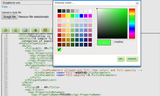
Style editor improvements
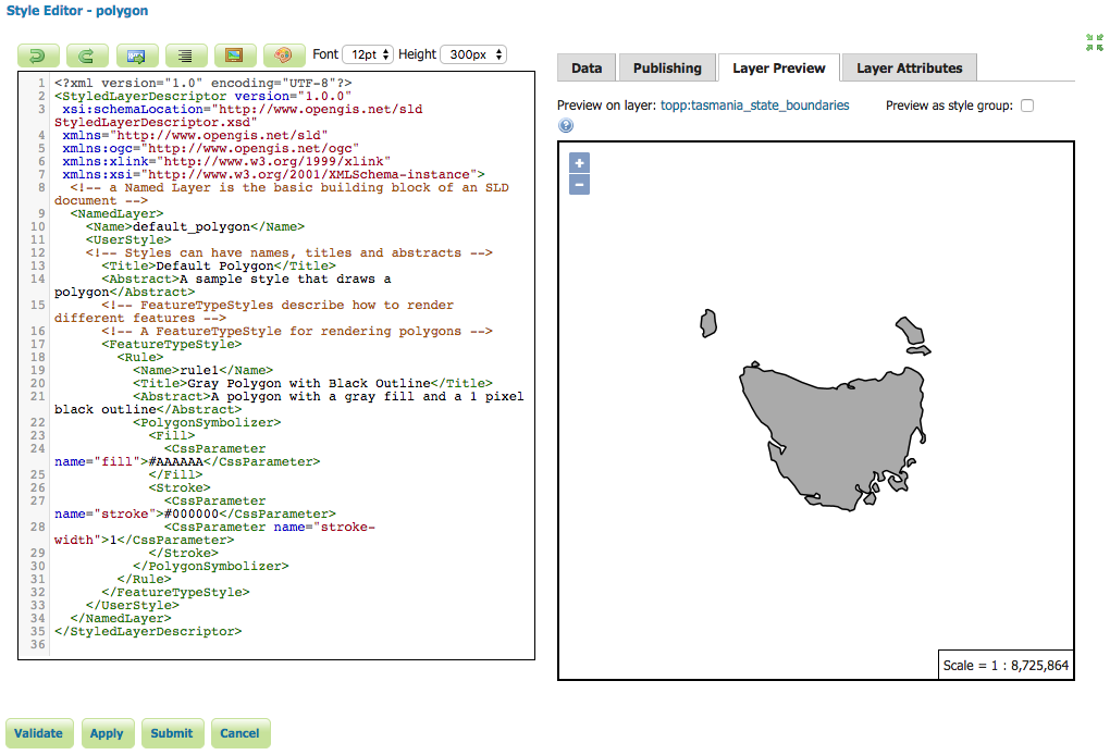
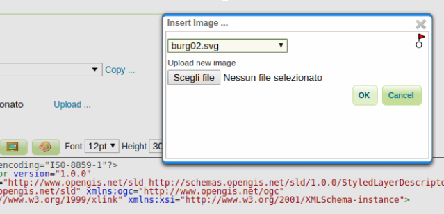
The GeoServer style editor now includes a fullscreen side-by-side editing mode, to make it easier to preview your styles while editing them. Click the fullscreen button at the top-right of the screen to toggle fullscreen mode.
The toolbar also has two new additions, a color picker helping to find the right color and turn it into a HEX specification, and a file chooser that allows to pick an external graphic and build the relevant ExternalGraphic element:
Windows build restored
GeoServer failed to properly build on Windows for a long time. GeoServer 2.14.x is the first branch in years to successfully build on Windows, and we have added an AppVeyor build to help keep the build going in the future.
The work to make it build there has been fully done in spare time, and we are still experiencing random build failures. If you are a Java developer on Windows, we could really use your help to keep GeoServer Windows build friendly.
New community modules
The 2.14 series comes with a few new community modules, in particular:
-
OAuth2 OpenID connect module (still very much a work in progress)
-
A WFS3 implementation has been added that matches the current WFS3 specification draft, and it’s being updated to become an official compliant one.
Mind, community modules are not part of the release, but you can find them in the nightly builds instead.
JTS Upgrade
Java Topology Suite (JTS) has been upgraded to version 1.16. This marks a significant change in package naming, the library has switched from “com.vividsolutions” to “org.locationtech” packages and all GeoServer code has been updated to follow suit.
This has some side-effects on output produced by REST featuretype and structured coverage requests, specifically the package names used for geometry types in the binding parameter of any geometry attributes.
Any REST clients which rely on this binding information should be updated to support the new names. GeoServer will still support reading the old “com.vividsolutions” names, but will only output the new”org.locationtech” names.
For more details, refer to the upgrade guide in the GeoServer documentation.
Other assorted improvements
| There are many improvements to look at in the release notes (2.14.0 | 2.14-RC), cherry picking a few here: |
-
The ncWMS community module has seen significant performance improvements
-
WPS has a CSV input/output supporting geometryless data, as well as geometries with WKT encoding, as well as supporting pure PNG/JPEG image for raster data
-
Time/Elevation parsers are no longer silently cutting the read data to 100 entries
-
The WMTS multidimensional GetHistogram operation is now significantly faster, and a new GetDomainValues operation allows to page through the values of a domain (time, elevation) that has too many values to be efficiently explored with DescribeDomain or GetFeature. The DescribeDomain was also improved to allow a selection of the domains that should be described.
-
The SLDService community module has now the ability to return a full SLD style (as opposed to snippets), allows for custom classification and custom color selection. Also, keep an eye on this module, as it’s about to graduate to supported status
-
The monitoring module can now log the hit/miss status of tiled requests, quite helpful to verify the benefit of caching, especially while using WMS direct integration
-
Fix ”Chunk [] is not a valid entry” error for the embedded GWC reload endpoint
-
Tiled layers preview does not use Proxy Base Url
-
featuretype.xml bindings reference com.vividsolutions.jts classes
Security consideration
Please update your production instances of GeoServer to receive the latest security updates and fixes.
This release addresses several security vulnerabilities:
-
Prevent arbitrary code execution via Freemarker Template injection
-
XXE vulnerability in GeoTools XML Parser
-
XXE vulnerability in WPS Request builder
-
Various library upgrades (see above) from versions with known CVEs
-
Potential access to admin pages without being logged in
Thanks to Steve Ikeoka, Kevin Smith, Brad Hards, Nuno Oliveira and Andrea Aime for providing fixes to these issues.
If you encounter a security vulnerability in GeoServer, or any other open source software, please take care to report the issue in a responsible fashion.
About GeoServer 2.14
-
State of GeoServer 2.14 (SlideShare)
-
GeoServer Ecosystem (SlideShare)
-
GeoServer Developers Workshop (SlideShare)
Vulnerability
- GeoServer 2.26.1 Release
- GeoServer 2.25.4 Release
- GeoServer 2.26.0 Release
- CVE-2024-36401 Remote Code Execution (RCE) vulnerability in evaluating property name expressions
- GeoServer 2.25.2 Release
- GeoServer 2.24.4 Release
- GeoServer 2.23.6 Release
- GeoServer 2.25.1 Release
- GeoServer 2.25.0 Release
- GeoServer 2.23.5 Release