GeoServer Blog
GeoServer 2.15-M0 Milestone Release
| We are happy to share a GeoServer 2.15-M0 milestone release with downloads (zip | war | exe), documentation (html | pdf) and extensions. |
This milestone release is provided for everyone considering a Java 11 operational environment in 2019. A milestone release provides a technology preview and a chance to support the development team with early feedback: your assistance and participation is requested!
This release is a result of participation in the OSGeo Java 2018 Code Sprint and is made in conjunction with GeoTools 21-M0 and GeoWebCache 1.15-M0. We would like to thank organizations participating in the code sprint (Boundless, GeoSolutions, GeoCat, Astun Technology, CCRi) along with sprint sponsors (Gaia3D, atol, osgeo:uk, Astun Technology). Our gratitude goes out to the individuals who worked so hard to bring everything together.
Java 11 Support
The provided binary download works with either Java 8 or Java 11. Tomcat 9 or newer is required for the WAR install.
We will the update the user guide compatibility list based on your feedback and testing of this 2.15-M0 milestone release. Please note that Java 11 no longer supports the Java 2 extension mechanism used for native JAI and native ImageIO.
This is a good opportunity to review your operational environment and help test GeoServer with the environment you intend to use in 2019.
Java Roadmap Considerations
Our initial concerns with respect to continued availability of the Java 8 platform have been alleviated by industry action and commitment. Extensive Java 8 support options are now available, with RedHat making a public commitment to contribute fixes to the OpenJDK 8 codebase, and a range of organizations committed to making OpenJDK 8 builds available on a range of platforms.
Oracle has changed to a six month release schedule, donating additional components to OpenJDK to make it lead platform. Long term support (beyond six months) is being offered from a range of organizations notably RedHat OpenJDK and Adopt OpenJDK.
The net effect of these changes:
-
If you have been using Oracle JDK up until now it is time to review your options
-
Java 8 will continue to be available
-
The Java ecosystem is now led by the open-source Open JDK project
See the GeoTools user guide for a table outlining the Java 8 and Java 11 alternatives to consider in the year ahead.
About GeoServer 2.15 Series
Additional information on the GeoServer 2.15 series:
-
Release Notes (2.15-M0)
-
Running on Java 11 (User Manual)
GeoServer 2.13.4 released
We are happy to announce the release of GeoServer 2.13.4. Downloads are available (zip, war, and exe) along with docs and extensions.
This is a maintenance release recommended for production use (for newer projects please use the 2.14.x series, as this is last community sponsored 2.13.x release). This release is made in conjunction with GeoTools 19.4 and GeoWebCache 1.13.4.
| Highlights of this release are featured below, for more information please see the release notes (2.13.4 | 2.13.3 | 2.13.2 | 2.13.1 | 2.13.0 | 2.13-RC1 | 2.13-beta). |
Improvements and Fixes
-
Significant speedup in WMTS capabilities document generation when source data is not in WGS84
-
GeoPackage improvements, speed up raster reading and reprojection, make sure global coverage GeoPackage can be displayed
-
Removed gml:id attribute from GML 3.1 encoding (was added in previous releases by mistake)
-
NetCDF output format improvement, fixing projection coefficients in some cases, make sure data packing takes into account all data slices when calculating linear transformation coefficients
-
WCS 2.0 compliance improvements, DescribeCoverage output schema compliance fixes when using GeoServer extensions, returning correct exception type when subsetting request is out of range on time/elevation/custom dimension axis
-
KML request handling fixes, support for sortBy and CQL filtering on layer groups
-
GWC related fixes, could not modify blobstore configuration without changing its name too, wrong axis order in configuration when saving EPSG:4326 gridset configurations
-
Styling related improvements, cannot read dynamic SLD served by an apache server, SLD 1.1 posted to the REST API resulted in garbled content
-
And various others, please see the release notes for details
About GeoServer 2.13 Series
Additional information on the 2.13 series:
-
Isolated workspaces (User Guide)
-
Coverage views from heterogeneous bands (User Guide)
-
State of GeoServer 2.13 (slideshare)
-
See the GeoServer 2.13.0 released announcement for visual guide to new features
GeoSever 2.14.1 released
| We are happy to announce the release of GeoServer 2.14.1. Downloads are provided (zip | war | exe) along with docs (html | pdf) and extensions. |
This is a stable release of the GeoServer 2.14 series and is recommended for all production systems. Users of prior releases of GeoServer are encouraged to upgrade.
This release is made in conjunction with GeoTools 20.1 and GeoWebCache 1.14.1. Thanks to all who contributed to this release.
| For more information please see our release notes (2.14.1 | 2.14.0 | 2.14-RC). |
Improvements and Fixes
This release includes a number of new features and improvements:
-
New coordinate formatting options for WFS layers
-
REST API granule management remove of metadata or all
-
Coverage view support for indexed color model
-
Check handling of WCS 2.0 time/elevation/range subsetting
-
WFS 1.1.0 handling of gml:id
-
WFS Shapefile and GeoJSON output now support geometry with measures
-
Fixes to the start.bat and shutdown.bat scripts on windows
About GeoServer 2.14 Series
Additional information on the GeoServer 2.14 series:
-
New MongoDB extension added
-
Style editor improvements including side by side editing
-
Nearest match support for WMS dimension handling
-
Upgrade notes documenting REST API feature type definition change
-
State of GeoServer 2.14 (SlideShare)
-
GeoServer Ecosystem (SlideShare)
-
GeoServer Developers Workshop (SlideShare)
GeoServer 2.13.3 released
We are happy to announce the release of GeoServer 2.13.3. Downloads are available (zip, war, and exe) along with docs and extensions.
This is a maintenance release recommended for production use (for newer projects please use the 2.14.x series, as 2.13.x will cease to be supported in a few months). This release is made in conjunction with GeoTools 19.3 and GeoWebCache 1.13.3.
| Highlights of this release are featured below, for more information please see the release notes (2.13.3 | 2.13.2 | 2.13.1 | 2.13.0 | 2.13-RC1 | 2.13-beta). |
Improvements and Fixes
-
Allow selection of geometry attribute in app-schema, support mapping files over HTTP connection, push spatial filters over nested geometries down into SQL when possible
-
Performance improvement when reporting dimension values in WMS capabilities, for dimensions out of raster data and presented as “interval and resolution”
-
WCS thread safety fixes when using requests with reprojection and rescaling under high load. Also, when requesting an area inside the bounds of a sparse mosaic, the result might have had less pixels than requested.
-
CSS translator fixed to support mark offset/anchors based on expressions
-
File chooser autocomplete had duplicate entries on Linux
-
REST config, it was not possible to set the default style using a layer PUT
-
GetLegendGraphic ignores the OnlineResource configured in the style for raster layers
About GeoServer 2.13 Series
Additional information on the 2.13 series:
-
Isolated workspaces (User Guide)
-
Coverage views from heterogeneous bands (User Guide)
-
State of GeoServer 2.13 (slideshare)
-
See the GeoServer 2.13.0 released announcement for visual guide to new features
GeoServer the most popular choice for Brazil SDI
Last week the Brazilian government released a list of government agencies that have already implemented their spatial data infrastructure (SDI). This list has 21 agencies, and the interesting thing is that 18 out of 21 use GeoServer in their SDI.
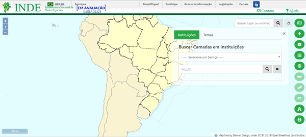 Portal of Brazil’s spatial data infrastructure
Brazil has a 2008 decree, which establishes the creation of spatial data infrastructure by government agencies, and since then, this process of spatial data availability has been growing in the country.
Below, the GeoServer address of some of these agencies:
A spatial data infrastructure (SDI) is a data infrastructure implementing a framework of geographic data, metadata, users and tools that are interactively connected in order to use spatial data in an efficient and flexible way (Wikipedia, 2018).